GeoSup logo
  • Home
    • About Us
    • Our Team
    • Mission & Vision
    • Contact Us
  • Researches
    • Cognitive Artificial Intelligence
    • Computer Vision & Photogrammetry
    • Sensor Design and Orientation
    • Thermogrammetry
    • Magnetometry
    • Navigation
  • Publications
  • 🇬🇧 EN
  • 🇮🇷 FA

UAV Detection With Modified YOLOV4

Home Blog UAV Detection With Modified YOLOV4
UAV Detection With Modified YOLOV4

UAV Detection With Modified YOLOV4

Avatar for AlizadehAlizadeh8 March 2025
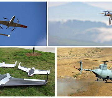
UAV Detection With Modified YOLOV4   Drones are widely used to serve various purposes in industry, mapping, and crisis management. However, the use of drones is increasing in ... Read More
Brand logo
GEO SUP

Advanced mapping technologies are applied across industries, from efficient mining and heritage protection to cost-effective urban planning, precise agricultural monitoring, spatial analysis in utilities, and vital support in rescue missions. These uses show their wide impact and importance.

Follow us on
in X f ▶

Useful links

Stay updated with the latest innovations and developments.
About GEO SUP Terms & Conditions Privacy Policy Contact Us

Company information

  • Open 8am to 7pm, Monday to Saturday
  • College of Engineering, University of Tehran, North Kargar Street, Tehran, Iran
  • Contact us at
    geopad.co@gmail.com
© All rights reserved by Geosup

    HomeServicesPlatformsSencors